Rob Brink
De Noordrand van Brussel en zijn verborgen potenties
This plan proposes to start looking at the Noordrand as an integral part of a large urban system, and not as a bordering wasteland between the regions of Brussels and Flanders. Strategic interventions in the landscape, a change in the way the mobility is managed in the region, and a new vision on the built and unbuilt programme is desperately needed in Brussels, and especially the Noordrand.
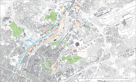
Brussels is shaped alongside the many valleys and streams in the landscape. The growth of the city in the 19th century led King Leopold II to ask Victor Besme to draw up and carry out a coherent composition of boulevards, parks and public buildings connected by trams, trains and trolleybuses, which still benefits the city today. Unfortunately, developments in the 20th century were carried out with less of an eye for urban quality, leaving Brussels with a Noordrand filled with infrastructural carriers, neglected neighbourhoods, grey and incoherent working zones and large amounts of residual spaces.
However the underused potential of gardens, fields, little plots of forest, valleys and parks, together with little treasures such as village centres, churches and industrial heritage scattered through the Noordrand, gives us unique tools to work with. One of the biggest untapped potentials of the Noordrand is its strategic position between the airport and the city centre, which could offer the same development potential as Amsterdam’s Zuidas and Zurich’s District 11.
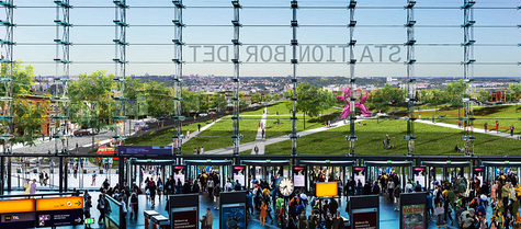
The demographic pressure on Brussels is rising, as the city is expected to grow by 100,000 inhabitants in the next 10 years, which is twice the growth Amsterdam is expecting. This growth can however be accommodated within the Noordrand, without sacrificing the open spaces it still has. The core of the Noordrand will, however, be shaped and fuelled by an international neighbourhood surrounding the new Bordet Station. This new station will play an important role in the urban traffic system, offering great mobility options. As this plan will demonstrate, the qualities of the landscape, the excellent mobility and the close proximity of the NATO headquarters offer a number of conditions that will attract businesses, hotels and facilities towards the neighbourhood around Bordet station.
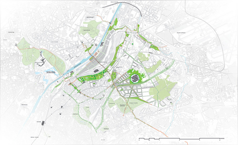
The existing infrastructure needs to be put to better use in order to reduce the traffic pressure, and to make the shift from a commuter traffic system, focused on inbound and outbound traffic, towards an interurban traffic system, connecting the neighbourhoods of the city. By adding a ring of public transport and bike lanes trough the Rand of Brussels and Flanders, the existing network as a whole can start functioning as a multimodal system. The public transport in Brussels will accommodate door-to-door mobility, and will also make it easier to use public transport for other activities next to commuting, such as visiting a park, a concert or visiting friends in a different part of the city.
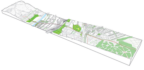
The existing open spaces and parks need to be used to improve the living quality, ecology and identity of the Noordrand. This plan proposes connecting the different spatial needs for development, by using the new development to frame the existing open spaces, in order to create added value and upgrade these spaces to public parks. By redesigning the flanks of the former marshalling yard Schaarbeek Vorming as a continuous space, a park on the scale of the region will be developed, which can connect the city of Brussels with Flanders as a green lung. This park, mostly situated on the flanks of the Zenne valley, will restore the identity of Brussels as a city of valleys and streams.
Commission members: Riëtte Bosch (mentor), Riika Tuomisto, Roeland Dudal. Additional members for the exam: Hans van der Made, Ad de Bont.


